Maps of Wyoming
Here is a collection of maps and resources for you next trip through Wyoming.
Buckle up! You’re traveling back through time on this ride!
Mormon Trail

On March 1, 1846, some 500 Mormon wagons lurched northwesterly across the winter-bare Iowa prairie toward the Missouri River. Their route is the Mormon Trail. To learn more, click here.
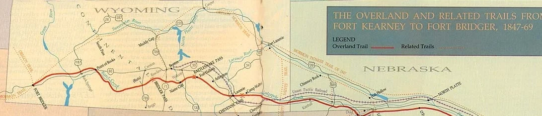
Overland trail
The Overland Trail and Stagecoach was an alternative route for people to take beside the Oregon Trail. A piece of this history still exists today with the Point of Rocks Stage Coach located in Sweetwater County. To learn more, click here.
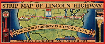
Lincoln Highway
The Lincoln Highway Association was established in 1912 for the singular purpose of establishing, “a continuous improved highway from the Atlantic to the Pacific,” the nation’s first transcontinental automobile road. To learn more, click here.
To learn more about what to do in Wyoming, check out: https://www.travelwyoming.com/